
Our planet today is experiencing some major environmental challenges. Ecosystem and landscape damage are some big worries. But we can fight back using drones. Yes, these small, unmanned flying machines are proving to be total game changers in restoring and reclaiming the damage.
Drones provide conservationists, government agencies, and environmental groups the next powerful tool in ecological restoration projects. The drones aid in reclaiming landscapes that are many times over and done with more efficiency than ever before. It is this cutting-edge tech that is transforming how to undertake major environmental repairs and reclamation.
Whether the task is replanting forests, reseeding grasslands, or stabilising coastlines, drones are doing the job big time. Their ability to fly and send high-quality data on mapping and surveying means restoration teams can achieve phenomenal results in getting these ecosystems back on track. Indeed, it is changing the game in efforts to make the planet green and healthy once more.
The Rise of Drone Technology in Restoration
The adoption of drone technology in land reclamation efforts has seen exponential growth in recent years. Many NGOs, governments, and environmental agencies are embracing this innovative approach, recognising its potential to revolutionise restoration initiatives.
Key breakthroughs, including LiDAR (Light Detection and Ranging), multispectral imaging, and precision planting, are driving this surge, enabling more precise and effective restoration strategies. According to a report, the use of drones in environmental projects has grown in the last five years, with land reclamation being one of the primary applications.
Strategic Partnerships and Industry Collaborations
Strategic partnerships between the public and private sectors have emerged to scale drone technology in land restoration. These collaborations involve knowledge sharing, resource allocation, and the development of cutting-edge solutions.
FEDS Drone-Powered Solutions is at the forefront of innovation, offering efficient and precise approaches to monitor and rehabilitate barren or contaminated areas. Their advanced drones, equipped with state-of-the-art sensors, can swiftly assess terrain conditions, identify areas in need of restoration, and disperse seeds or nutrients to kickstart the reclamation process.
In the UAE, drone companies are utilising advanced technologies to address land degradation and promote ecosystem health. Drone companies in UAE play a leading role in employing unmanned aerial vehicles (UAVs) for land restoration and rehabilitation projects.
Our partnership with BioCarbon Engineering has been instrumental in our efforts to restore Kenya’s forests. We can now plant millions of trees in previously inaccessible areas using drones, thus making progress toward a greener future.
Drone Applications in Land Restoration Projects
Data Collection and Environmental Monitoring
Drones have taken data collection and monitoring in the environmental sector to new heights in terms of land reclamation. These small aerial workhorses are kitted with super-high-resolution cameras and LiDAR sensors capable of scanning entire landscapes.
Aided by aerial imaging and 3D mapping, drones can find exactly where the land has been degraded and what needs attention. The aerial imagery can locate spots crying for reforestation, fight erosion issues, or spots overrun by invasive plant/animal species; these are some areas that need urgent attention. This detail from above can be provided by them.
Restoration teams with drones will be positioned to work on pinpointed spots needing restoration in a laser-focused, efficient manner. Their efforts and resources can be focused in the most pinpointed way to achieve the greatest impact. Instead of guesswork, it’s data-driven environmental repair.
Precision Reforestation and Planting
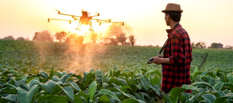
One of the most amazing ways drones are used in environmental reclamation is through high-tech reforestation and replanting. These little crafts can fly around autonomously and seed pods into the ground with insane accuracy and speed.
Companies such as BioCarbon Engineering have put drone seeding technology to work by deploying fleets of planters from the sky, literally helping them replant 1 billion trees a year. Organisations can supercharge their efforts in reforestation and replanting with the help of drones.
Soil Quality Assessment and Restoration
Drones equipped with multispectral imaging sensors assess soil quality, providing invaluable data for reclamation strategies. Analysing soil health parameters like moisture, nutrient levels, and organic matter allows drones to guide site-specific interventions, creating optimal conditions for ecosystem recovery.
Monitoring and Impact Assessment
Drones continue to be useful beyond initial restoration efforts, monitoring plant growth, soil stabilisation, and ecosystem recovery over time. The data collected by drones helps conservationists assess the impact of their efforts, identify areas needing additional attention, and optimise future reclamation strategies with empirical evidence.
Benefits of Using Drones in Land Reclamation
- Cost Efficiency: Drones are more cost-effective than traditional land reclamation methods, reducing operational expenses, minimising the need for extensive human resources, and efficiently managing resource allocation.
- Speed and Scale: Drones can cover vast areas quickly, enabling rapid restoration efforts in remote or inaccessible regions. This speed and scalability are vital for urgent environmental challenges.
- Data-Driven Decisions: High-quality data collected by drones allows for informed decisions in reclamation strategies, tailoring them to each landscape’s specific needs for successful restoration.
Challenges of Using Drones for Land Reclamation
- Regulatory Hurdles: Land reclamation projects using drones face airspace regulations that vary across countries and regions. Navigating these regulations can be complex and time-consuming, hindering drone technology’s widespread adoption.
- Technical Limitations: Despite the advantages, drones have technical limitations such as limited flight time and payload capacity. These constraints can impact the scope and duration of land reclamation projects.
- Data Management: The vast amounts of data collected require robust data management systems and analytical tools. Processing and interpreting this data requires skilled personnel and sophisticated infrastructure.
To overcome these challenges, collaboration between stakeholders, including governments, conservation organisations, and technology companies, is essential. By working together, they can address regulatory concerns, advance drone technology, and develop efficient data management solutions for effective land reclamation.
Case Studies
The Amazon Rainforest Reforestation Project
In collaboration with the World Wildlife Fund (WWF) and Conservation Drones, drones have played a key role in reforesting large areas of the Amazon rainforest. Using precision planting techniques, over 1,000 hectares have been replanted with native tree species, restoring the region’s biodiversity and ecological balance.
Mangrove Restoration in Myanmar
The Worldview International Foundation used drones to restore mangrove forests in Myanmar, a critical ecosystem for coastal protection and habitat conservation. Targeted planting efforts successfully restored over 750 hectares of mangrove forests, enhancing the region’s resilience to natural disasters and providing safe habitats for numerous species.
Erosion Control in Australia’s Outback
In Australia’s Outback, drones are invaluable for mapping and restoring erosion-prone areas. By identifying and targeting erosion hotspots, drones enable sustainable farming practises and soil conservation measures, protecting the region’s delicate ecosystems.
These case studies show the real-world impact of drone technology in land reclamation across diverse ecosystems worldwide.
Embracing the Future
An even brighter future is on the horizon for the use of drones in environmental restoration work. Such cutting-edge innovation will include AI-powered mapping and coordinated drone swarms, along with the use of blockchain technology to verify impacts.
This is an exciting time for the interfusion of technological and conservation applications. Drones are on the verge of playing a major role in the restoration of the largest, most fragile, damaged, or interrupted ecosystems on our planet. The potential is massive.
In this regard, the time has come to act. Taking on drone tech and partnering heavily can kick land reclamation projects into overdrive and lock in a greener, more sustainable future that could be secure for generations to come. Innovation is the key to restoring a delicate natural balance.
So get involved with organisations using drones to bring ecosystems back to life. Support their work, and let’s work together to make a real lasting impact and leave an environmental legacy for future generations.
This is about securing a greener tomorrow. Drones provide the opportunity to heal landscapes and habitats. It’s a movement you’ll want to be part of to make a difference for the planet. The future is green when you put both conservation and the new, brilliant technologies of drones together. An environmental renaissance lies before us.
Frequently Asked Questions
How do drones improve efficiency and accuracy in land reclamation efforts?
Drones significantly improve land reclamation efforts by offering high-resolution imaging and accurate GPS mapping. This allows for the precise identification of degraded areas. With autonomous planting and real-time data processing, drones enhance efficiency in reclamation, ensuring that the restoration process is effective and well-targeted.
What types of landscapes and ecosystems are best suited for drone-assisted restoration?
Drones perform exceptionally well in a variety of ecosystems, including forests, wetlands, and arid landscapes. They are particularly useful in remote and sensitive regions that require minimal human disturbance, making them ideal for large-scale restoration projects.
What are the key regulatory considerations when deploying drones for land reclamation?
Key considerations for deploying drones include securing flight permits, understanding jurisdictional airspace rules, and complying with data privacy regulations. Cooperation with local authorities and adherence to global UAV guidelines are crucial for successful and compliant drone use in land reclamation projects.